


Hiking Apps: How to Choose the Right One for the Trail
Hiking apps can make it easier to find trails, plan a route, and keep track of a hike. Many offer maps, elevation profiles, turn-by-turn guidance, and tools for sharing a trip plan. They can be useful for everyone from casual walkers to experienced backpackers—but no app replaces preparation, sound judgment, or a paper map and compass when conditions call for them.
What Hiking Apps Can Do
Features vary by app, but common tools include:
- Trail discovery: Search for routes by location, distance, difficulty, elevation gain, or activity type.
- Maps and navigation: View your location on a map, follow a route, or record where you have traveled.
- Offline access: Download maps or routes before leaving areas with limited or no cell service. Offline features may require a paid plan.
- Route details: Review distance, estimated time, elevation changes, and trail descriptions.
- Trip planning: Save routes, create itineraries, and share plans or location information with others.
- Community updates: Read recent reports about trail conditions, closures, or hazards. These reports can be helpful, but may not be current or officially verified.
Types of Hiking Apps
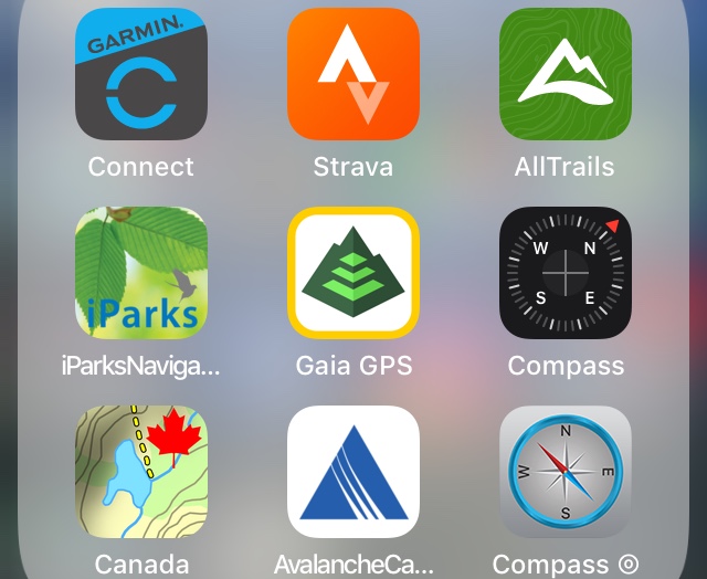
Some apps are designed mainly to help people discover popular trails, while others focus on detailed navigation and map tools. For example, AllTrails is widely used for finding and reviewing routes. Gaia GPS and onX Backcountry offer mapping and navigation features aimed at users who want more detailed route planning. Features and subscription options change, so check each app’s current description before relying on a particular tool.
Official land-management websites and apps can also be valuable sources for information about park rules, permits, closures, and alerts. A hiking app’s trail listing does not necessarily confirm that a route is open or appropriate for current conditions.
How to Choose an App
The best app depends on where you hike and what you need. Before choosing one, consider:
- Offline maps: Can maps be saved to your phone for use without service?
- Coverage: Does the app include reliable maps for the areas you visit?
- Navigation tools: Does it show your location, track your route, or provide useful elevation information?
- Ease of use: Can you read the map and find key features quickly, including in poor weather?
- Cost: Which features are free, and which require a subscription?
- Battery use: How long can your phone run the app with GPS enabled?
- Privacy: Review location-sharing settings and decide who can see your routes or activity.
Prepare Before You Go
Download maps and route information while you have a reliable internet connection. Check that the map is available offline, then open it in airplane mode to confirm it works. Bring a fully charged phone and consider carrying a power bank on longer hikes. Cold temperatures, screen brightness, and constant GPS use can drain a battery faster than expected.
Tell someone where you are going, when you expect to return, and what to do if you do not check in. For remote trips, a satellite messenger or personal locator beacon may provide a way to contact emergency services where cellular coverage is unavailable. These devices have different capabilities and may require a subscription.
Use Apps Alongside Other Navigation Skills
A phone can be damaged, lost, or depleted of power. Before setting out, learn the basics of reading a map and using a compass, and carry appropriate backup navigation tools for the trip. Stay on marked routes, pay attention to signs and terrain, and turn back if conditions or your situation make continuing unsafe.
Hiking apps are most useful as part of a broader plan. Choose one that fits your needs, prepare it before leaving home, and verify important details—such as trail access, weather, permits, and closures—with official sources. With the right preparation, an app can help make a hike easier to plan and more enjoyable to follow.
Hiking App FAQs: Offline Maps, GPS Accuracy, Battery Life, and Safety
- What are the best hiking apps for beginners?
- Do hiking apps work without cell service?
- Which hiking apps offer free offline maps?
- How accurate are hiking app maps and GPS locations?
- Can hiking apps drain my phone battery quickly?
- What features should I look for in a hiking app?
- Are hiking app trail conditions and reviews reliable?
- Can I use a hiking app instead of a paper map and compass?
- How can I share my hiking route or location with someone?
What are the best hiking apps for beginners?
For beginners, AllTrails is a popular choice because its simple interface, trail descriptions, difficulty ratings, and user reviews make it easy to find a suitable route. Hiking Project and the free version of Gaia GPS are other options to explore, though features and availability can vary by area. Before setting out, check recent trail conditions and official park alerts, and download an offline map if your app offers one—cell service may be unreliable on the trail.
Do hiking apps work without cell service?
Yes, many hiking apps work without cell service if you download the trail map or route to your phone before you leave. Your phone’s GPS can often show your location on a saved map without an internet connection, but features such as live updates, trail reviews, and location sharing may not work. Check that the map is available offline before your hike, and bring a backup navigation option in case your phone loses power or is damaged.
Which hiking apps offer free offline maps?
Organic Maps offers free offline maps based on OpenStreetMap data, making it a useful option for basic trail navigation; OsmAnd also provides free offline map downloads, though some features or download limits may depend on the version. Avenza Maps lets you download maps for offline use, and many are free, but availability and cost vary by map. Check that your chosen trail is covered and download the map before you leave—offline maps may not include current closures or trail conditions.
How accurate are hiking app maps and GPS locations?
Hiking app maps and GPS locations are helpful, but they are not always perfectly accurate. GPS precision can vary with terrain, dense forest, steep canyons, weather, and your phone’s hardware, while trail maps may be outdated or based on user-submitted information. Treat the app as a guide rather than an authority: download maps before your hike, check trail conditions and closures with official sources, watch for signs and landmarks, and carry a paper map and compass on remote or challenging routes.
Can hiking apps drain my phone battery quickly?
Yes, hiking apps can drain your phone battery quickly, especially when GPS tracking, navigation, a bright screen, or frequent map updates are in use. Cold weather and weak cell signals can also reduce battery life. Before your hike, download maps for offline use, lower your screen brightness, close apps you don’t need, and use airplane mode when you don’t need a cellular connection. Bring a fully charged power bank on longer trips, and don’t rely on your phone as your only navigation or emergency tool.
What features should I look for in a hiking app?
When choosing a hiking app, look for reliable maps and GPS navigation, plus the ability to download maps for offline use since cell service may be limited on the trail. Helpful features include trail details such as distance, elevation gain, and estimated time; route planning and tracking; recent trail-condition updates; and safety tools such as location sharing. Also consider ease of use, battery consumption, coverage in the areas you hike, and whether key features require a subscription.
Are hiking app trail conditions and reviews reliable?
Hiking app trail conditions and reviews can be helpful, but they aren’t always current or verified. Conditions may change quickly due to weather, seasonal closures, erosion, or maintenance, and a review may describe a different route or time of year. Check the date and details of recent reports, then confirm closures, alerts, and access information with the relevant park or land-management agency. On the trail, follow posted signs and be prepared to adjust your plans.
Can I use a hiking app instead of a paper map and compass?
A hiking app can be a helpful navigation tool, but it shouldn’t be your only backup. Phones can lose power, get damaged, or fail to receive a signal, so download maps for offline use and bring a paper map and compass on hikes where navigation matters. Learn how to use them, and check your route and trail conditions before you go.
How can I share my hiking route or location with someone?
Most hiking apps let you share a planned route, a recorded hike, or your live location through a link, text message, or in-app feature. Before you leave, check the app’s sharing settings, confirm the recipient can open the link, and make sure live tracking works in areas with service; coverage may be limited on the trail. For safety, tell someone your route and expected return time, and agree on what they should do if you don’t check in.


