

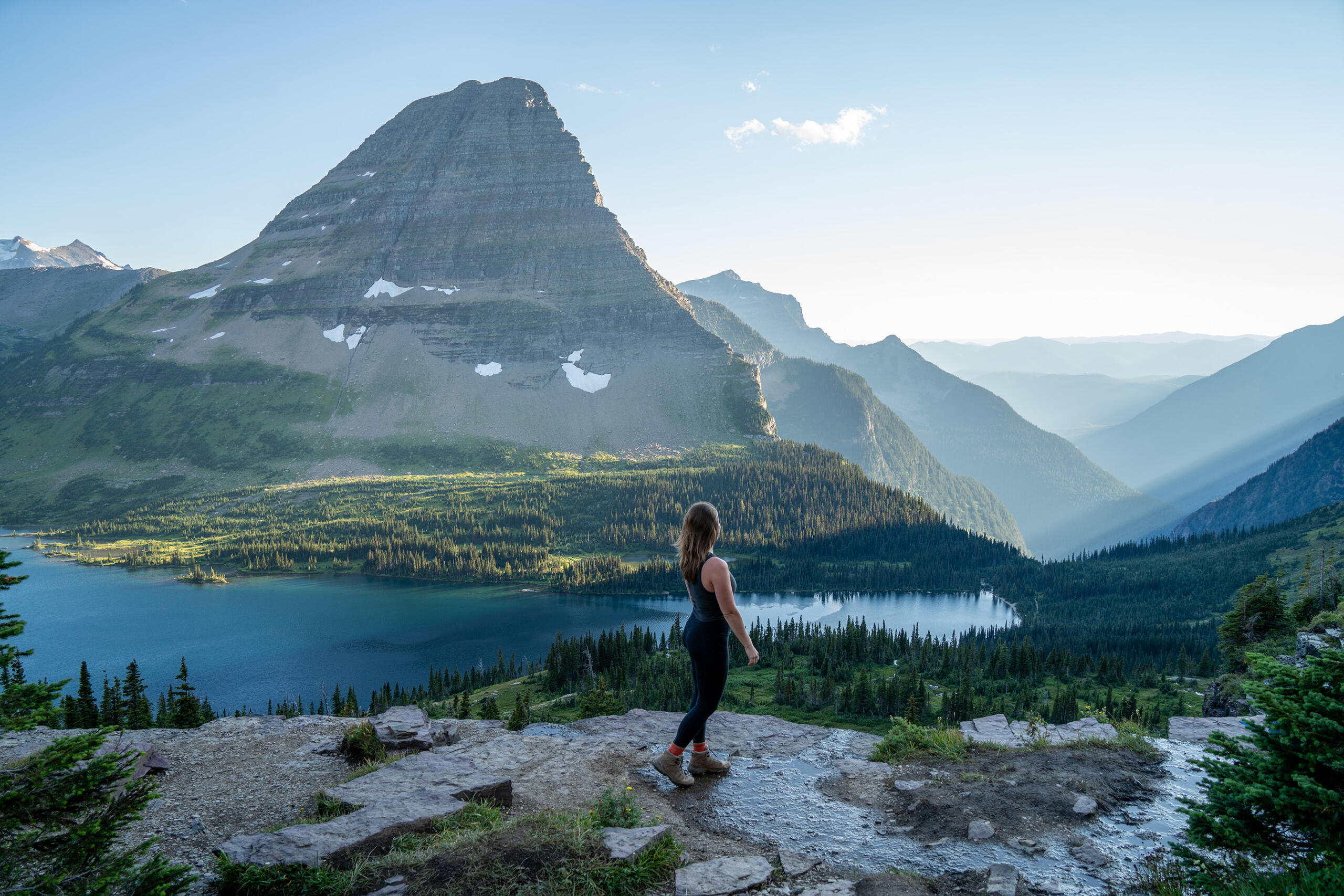

Exploring the Highline Trail in Glacier National Park
The Highline Trail is one of the most celebrated hikes in Glacier National Park, Montana. Traversing the steep slopes of the Garden Wall, this alpine route offers sweeping views of glacial valleys, rugged peaks, and wildflower-filled meadows. Its dramatic scenery and relatively modest elevation gain make it a favorite among experienced hikers and adventurous visitors alike.
Trail Overview
The classic route begins at Logan Pass on Going-to-the-Sun Road and ends at The Loop, covering about 11.8 miles one way. The hike is generally downhill overall, though it includes rolling sections and a sustained descent near the end. Because the trail finishes at a different location from where it starts, hikers need to plan transportation back to Logan Pass. Park shuttle service and road access can change by season, so check current conditions before setting out.
For a shorter outing, hikers can walk part of the trail from Logan Pass and return the same way. The route’s famous ledge section appears near the beginning. A cable is fixed to the rock wall for support, and the exposed path may feel uncomfortable for anyone uneasy with heights. Take your time, keep to the trail, and follow any closures or ranger instructions.
What to Expect Along the Way
From the trail, hikers can look across the broad expanse of the Garden Wall toward peaks and valleys shaped by glaciers. The route passes alpine meadows and slopes where wildflowers bloom during the summer. Wildlife sightings are possible, including mountain goats, bighorn sheep, and marmots, though animals are never guaranteed.
A popular side trip climbs to the Grinnell Glacier Overlook. This steep spur adds significant effort and elevation gain, but rewards hikers with a striking view into the glacial basin. Conditions can vary, and snow may linger in high-elevation areas, so assess the trail and your energy before adding the detour.
Planning a Safe Hike
- Check access and weather: Logan Pass is reached via Going-to-the-Sun Road, which can be affected by snow, construction, traffic, and seasonal closures. Review the latest park updates before traveling.
- Start early: Parking and shuttle availability can be limited, especially during busy summer days.
- Bring essentials: Carry water, food, sun protection, sturdy footwear, and extra layers. Mountain weather can shift quickly.
- Prepare for wildlife: Carry bear spray where permitted and know how to use it. Give wildlife plenty of space, never feed animals, and follow park guidance.
- Choose the right route: The full point-to-point hike requires transportation planning and stamina. Turn around if conditions or fatigue make continuing unsafe.
A Memorable Glacier Experience
The Highline Trail combines remarkable mountain scenery with a sense of adventure. Whether you hike a short section near Logan Pass or tackle the full route to The Loop, careful preparation helps make the experience safer and more enjoyable. Check current park conditions, respect the alpine environment, and leave time to take in the views along the way.
Highline Trail FAQs: Length, Difficulty, Route, Heights, Shuttles, and Best Time to Hike
- How long is the Highline Trail in Glacier National Park?
- How difficult is the Highline Trail?
- Where does the Highline Trail start and end?
- Is the Highline Trail safe for hikers who are afraid of heights?
- How do you get back to Logan Pass after hiking the Highline Trail?
- When is the best time of year to hike the Highline Trail?
How long is the Highline Trail in Glacier National Park?
The Highline Trail in Glacier National Park is about 11.8 miles one way from Logan Pass to The Loop. Because it’s a point-to-point hike, plan transportation back to your starting point. The distance can vary if you take side trips, such as the steep spur to Grinnell Glacier Overlook, or hike only part of the trail and return to Logan Pass. Always check current trail and road conditions before heading out.
How difficult is the Highline Trail?
The Highline Trail is generally considered strenuous because of its length, uneven terrain, exposure, and changing mountain weather. The classic hike from Logan Pass to The Loop is about 11.8 miles one way, with a long descent near the end; the narrow, exposed ledge section near the start can also be challenging for people uncomfortable with heights. Hikers seeking an easier outing can walk part of the trail and turn back. Check current trail conditions, bring plenty of water and layers, and choose a distance that matches your fitness and comfort level.
Where does the Highline Trail start and end?
The Highline Trail in Glacier National Park typically starts at Logan Pass Visitor Center on Going-to-the-Sun Road and ends at The Loop, covering about 11.8 miles one way. Since it’s a point-to-point hike, plan transportation back to Logan Pass; shuttle schedules and road access can vary by season, so check current park updates before you go.
Is the Highline Trail safe for hikers who are afraid of heights?
The Highline Trail may be uncomfortable for hikers who are afraid of heights, especially along the narrow, exposed section near Logan Pass, where a cable is fixed to the rock wall for support. The trail is maintained, but the cable does not remove the exposure, and conditions can make footing more challenging. If heights cause significant anxiety, consider choosing another hike or walking only as far as feels comfortable; hikers can turn around at any point. Check current trail conditions and follow park guidance before setting out.
How do you get back to Logan Pass after hiking the Highline Trail?
The Highline Trail’s classic route ends at The Loop, not Logan Pass, so you’ll need to arrange a ride back to your starting point. When operating, the park’s shuttle may connect The Loop and Logan Pass, but service, schedules, and pickup locations can change seasonally. Check the latest Glacier National Park transportation updates before your hike, and allow extra time for delays. If the shuttle isn’t available, arrange a private pickup or hike an out-and-back section from Logan Pass instead.
When is the best time of year to hike the Highline Trail?
The best time to hike Glacier National Park’s Highline Trail is usually mid-July through September, when much of the snow has melted and the trail is more likely to be accessible. Conditions vary from year to year, and snow, weather, wildlife activity, or closures can affect access; Going-to-the-Sun Road access to Logan Pass is also seasonal. Check current National Park Service trail and road updates before your visit.


